Problem Statement:
NASA currently is working on their Highway in the Sky software to designate roads in the sky. The software appears to be missing one piece of the puzzle that is critical to it's success. The problem is that in the event of a crash scenario, due to engine failure or other failure, where would a personal aircraft land and what would be the best path for a successful landing. The reason this is a problem would be the fact that personal aircraft would tend to fly at a lower altitude than a commercial aircraft, which means there would be less time to react to an emergency situation.
Solution Statement:
Add a new module to the Highway in the Sky Software that would plan for a crash landing of a personal aircraft.
It would required two inputs fro the solution
1) Designated Crash Zones (IE: Small Runways)
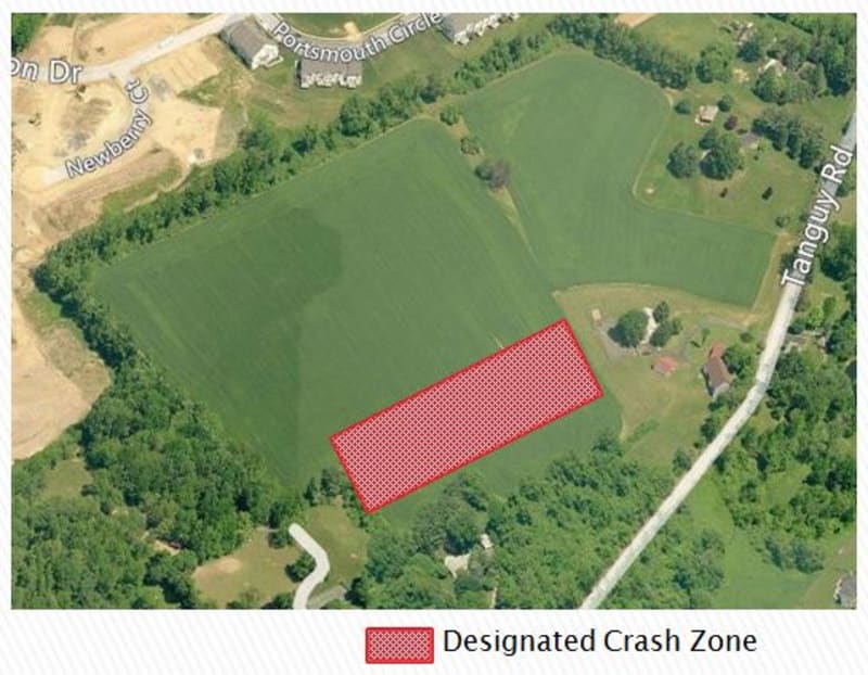
The first input required would be for NASA to designate crash zones that are near the virtual highway. These zones would essentially be small runways on public or private property that would meet certain requirements. For Example, the zone would need to be 1000 feet long and 300 feet wide, be relatively flat and free of debris.
2) Crash Path Calculation
A new software module that would be required that would link the personal aircraft to the Designated Crash Zones. The software would constantly update the best crash path based on the aircraft's current location and the closest Designated Crash Zone.
Like this entry?
-
About the Entrant
- Name:Crash Zone
- Type of entry:individual
- Patent status:none


