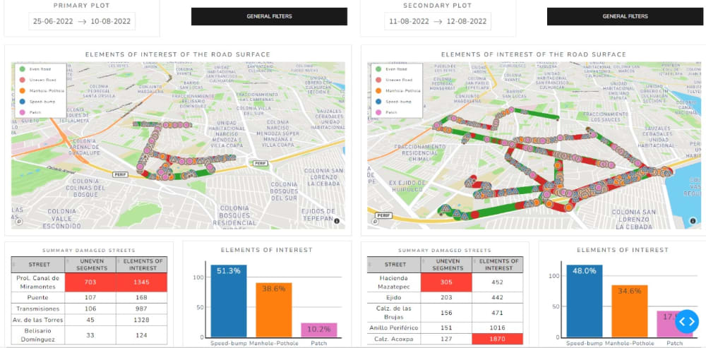
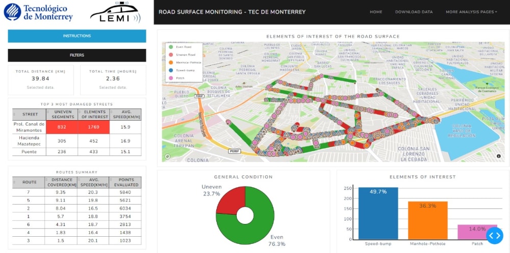
The problem to be addressed originates from the inherent deficiencies in traditional pavement monitoring methods for road networks. These methods primarily rely on periodic visual inspections conducted by human personnel, which present significant limitations. Firstly, manual inspection is costly and requires considerable human and financial resources, limiting its applicability to large road networks like that of Mexico City. Additionally, the geographical coverage and frequency of these inspections are often insufficient to fully and timely capture the pavement condition evolution across the road network.
Another important limitation lies in the subjectivity and inconsistency inherent in visual assessments performed by human inspectors. The precise identification and classification of different pavement damages, such as potholes, cracks, patches, and sinkholes, can vary significantly based on the inspector’s experience and judgment, resulting in unreliable and imprecise pavement condition reports.
Furthermore, the lack of continuous, real-time pavement condition monitoring hinders early detection of emerging issues and proactive maintenance responses. This can lead to increased safety risks for road users, as well as a higher likelihood of traffic congestion and premature infrastructure deterioration.
The challenge of pavement monitoring in road networks stems from the lack of efficient, accurate, and timely methods to identify and classify pavement damages, as well as the inability to achieve continuous condition monitoring. This situation underscores the urgent need to develop an advanced monitoring system that leverages innovative technologies, such as artificial intelligence, to enhance precision, efficiency, and timely response to road maintenance challenges.
Justification: Urban infrastructure plays a vital role in connectivity and development in Mexico City. However, effective management and maintenance of this road network face numerous challenges, from early identification of pavement deterioration to resource optimization for repairs and maintenance. These challenges are exacerbated as the city grows and lead to inappropriate or risky behaviors by drivers and road users. In 2017, approximately 19 million daily trips occurred within the city, with 77% of those trips using the road network. By 2020, the road network extended to 13,349 km.
Interestingly, most of these land trips were made by public transportation and private vehicles, totaling nearly 8 million daily trips. This high mobility demand highlights the critical need to accelerate the transformation of the city’s mobility and transportation system. It must be integrated, inclusive, safe, and clean, resulting in a dignified and secure travel experience for all users. Therefore, the development of an advanced monitoring system based on artificial intelligence technologies becomes a fundamental solution to address these difficulties and ensure effective and sustainable management of Mexico City’s road infrastructure, directly benefiting millions of citizens who rely on a safe and efficient transportation system for their daily commutes.
Benefited Population: The implementation of an advanced monitoring system would benefit road users, transportation agencies, and the general public by improving safety, reducing congestion, and extending the lifespan of road infrastructure
Video
Like this entry?
-
About the Entrant
- Name:Javier Izquierdo
- Type of entry:teamTeam members:
- Luis Alejandro Arce Saenz
- Patent status:none


