Flight delays and cancellations due to weather, cost commercial aviation dearly. Landing is the most safety critical part of flight. Landing in low visibility conditions, characterized as Cat II & III in aviation terminology, requires a very elaborate set of facilities and lots of real estate. Problem of low visibility is solved to a certain extent by Enhanced Flight Vision System which generates visual images of the runway and surroundings making landing under Visual Flight Rules possible. However, this does not allow automated landings, which largely rely on Instrument Landing System or GNSS GBAS landing system. Both these aids are prone to performance degradation due to external factors and require extensive ground support set up.
The proposed system will allow automated landings primarily using aircraft weather radar ground mapping mode and some symmetrically installed quadhedral reflectors besides the runway. These reflectors are simple to manufacture and will be accommodated well within the existing airfield premises. Unlike existing ground based systems aircraft avionics will provide the landing cues and determine system performance so the pilot has complete situational awareness. The system will be capable of providing curved landing approaches supporting ATM requirements which presently requires GLS/ILS combination . The system can be used on both ends of the runway.
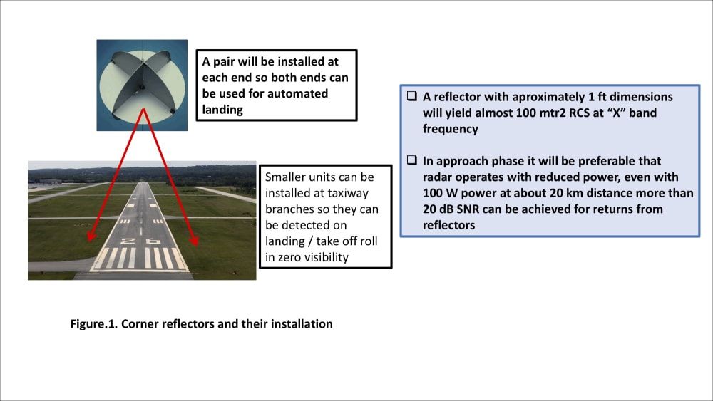
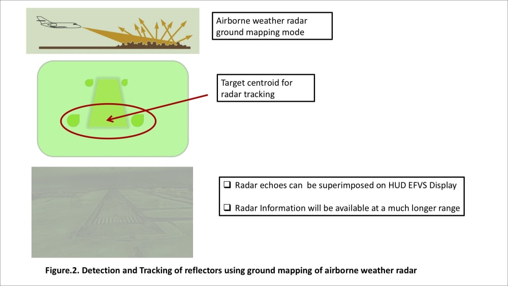
One of the available operational modes in contemporary airborne weather radars is ground mapping mode that can paint the ground contours like runways. Relative azimuth and range of a particular ground target with reference to aircraft position can be measured. Overall performance of this mode will have to be enhanced by adding features like beam splitting for better angular resolution. Each aircraft can be assigned an independent pulse code sequence so that transmission of multiple aircrafts do not interfere. Once a fix on the reflectors on runway approach end has been acquired, aircraft navigation computers will run an algorithm similar to that used for guiding missiles to the target and compute aircraft flight path to touch down point i.e. center of the two reflectors. To enhance detection it is proposed that quadhedral reflectors be installed symmetrically line abreast to the runway approach end, at a safe distance, please refer to attached Fig.1. In the attached figure file. These reflectors are very similar to those used by small boats so that they are detected by marine radars and will be around 1 ft high.
The proposed system has the potential to enable airports in congested space or resources to have an all weather automated landing facility. Even allowing curved approaches. Its performance will not be dependent upon environmental factors or interference from other sources. Ground units manufacturing is a relatively simple process, upgrade of airborne radars will require coordination with avionics manufacturers and system integrators will implement the radar processing and navigation algorithms. The overall cost will be much less than that of current automated landing systems. This system has the potential to attract whole international aviation. As no new airborne unit is being added, certification should be relatively smooth.
Like this entry?
-
About the Entrant
- Name:Irfan Majid
- Type of entry:individual
- Software used for this entry:Matlab/Simulink
- Patent status:none


