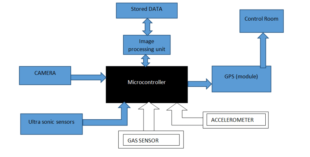
Almost everybody uses or is affected by the use of roads. Road networks facilitate transport services. In most countries, roads are the major transport mode.While driver errors such as speeding, distracted driving and drunk driving are among the leading causes of automobile accidents. Dangerous conditions also arise from the poor physical condition of a road and its surroundings. This project aims on detection, identification of problem faced by drivers, cyclist, pedestrians etc. and transmission of that data to maintenance authorities. The project intelligently uses GPS, sensor and image processing technique.
OBJECTIVE
1. To develop a system which can detect an obstruction caused by overgrown vegetation, posters etc. which blocks the view traffic signal, traffic sign boards etc.
2. To develop a system which can identify dangerous physical condition of a road and its surrounding such as potholes, cracks, unmarked crossings , low light intensity etc.
3. To develop a real time system which takes continuous input from surrounding and identify problem which may cause difficulty to drivers, pedestrians etc.
4. To develop a suitable algorithm that can simulate an intelligent traffic signal simulator that will able to sense the presence or absence of vehicles within certain range and also able to sense any non-movement of vehicle like in case of accident, illegal parking, vehicle breakdown and many more.
5. To develop a system which is capable of check pollution level and traffic status using image processing or sensor or combination of both and can send real time data to control room.
6. To develop system which can identify potholes and faded road marking o roads.
EXPLANATION
• Instead of manual checking of road condition, an intelligent system can be used which can detect problem related to road conditions and traffic signal visibility.
• The complete system can be fitted in any government vehicle and it will automatically identify problems faced by drivers while driving because of poor roads conditions and road surrounding.
• It can be programmed such that it can send real time traffic status using GPS.
• The system use sensors, infra-red or ultraviolet light to detect emissions of vehicles passing by on roads, and capturing the image of number plate and sending it to control thus eliminating the need for manual pollution check.
• An algorithm can design to make sure that the same problem is not reported multiple times.
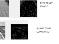
• Manual inspection of overgrown tree on road side which are obstruction for traffic sign, street light, etc can be replaced by this system which use image processing for obstruction identification and can send precise location using GPS.
• The system uses ultrasonic sensor for potholes and faded road marking identification
Applications:
1. LIGHT INTENSITY
2. POLLUTION CHECK
3. IDENTIFY POTHOLES AND CRACKS
4. TRAFFIC STATUS
5. System can be used to send the real time status of road condition so that in emergency driver or operator can reschedule its route.
6. The system can be integrated with automatic traffic control system as a combined operating unit.
Like this entry?
-
About the Entrant
- Name:Sachin Vats
- Type of entry:teamTeam members:SACHIN VATS AKSHAY KUMAR VISHES KUMAR YADAV
- Software used for this entry:Embedded system language, Java
- Patent status:pending


