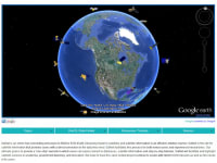
Times have changed and information is king but an important area to understand our world is still shrouded in much mystery: remote sensing from satellites. SatNet is an online hub connecting end-users to EOS (Earth Observing System) satellites and information in an efficient, intuitive manner. Currently, there is no single site for satellite information that provides users with a direct connection to the information they need. SatNet will bridge this gap and facilitate this process for both novice users and experienced researchers. Our ultimate goal is to provide a “one-stop” website in which users can easily connect to databases and satellite information. SatNet will facilitate and highlight satellite services in academia, government planning, and recreation.
The EOS has provided a wealth of information on Earth’s natural systems and their complex interactions, tracking everything from water resources to deforestation and cloud structure. However, the accessibility of this information is highly limited by the complicated distribution system, particularly for users beyond the space and earth science research communities. This is primarily caused by the isolation of the various entities responsible for distributing satellite data. Each of these organizations has their own protocol and conventions for accessing the satellite information that they manage, producing a challenging and arduous process for acquiring satellite data.
NASA provides satellite resources mainly to researchers but is open to the public as well. While the satellites do an outstanding job of producing earth observing information, the delivery of this information to potential users is complicated and confusing for novice users. The data is tough to locate, difficult to understand, and complex to process. While a small number of scientists and researchers have the technical experience to utilize this information, many scientists and researchers do not, not to mention the general public. Potential users of satellite information cannot quickly and easily obtain satellite information. Accessing satellite data is a cumbersome and highly-technical process that prevents all but the most experienced users from actually using satellite information. A large amount of potential problem solvers from academia, government and the public do not utilize satellite information for this very reason. In addition, they do not know how it can be useful in their work and lives, further limiting solutions to many of the world’s complicated or “wicked” problems.
The solution to this frustrating system is a website that acts as an intermediary, connecting users to satellite data and uses in an intuitive format utilizing an algorithm for converting raw data from existing and future sources to usable information, and including assisting tutorials for the various formats along with information on EOS. We have named this website Satellite Network, or SatNet. SatNet will focus on these key elements, eliminating the confusion and difficulty of searching for, accessing, and processing satellite information. This satellite network will herald in a revolution of global perspective and welcome new solutions to accelerating world challenges.
Like this entry?
-
About the Entrant
- Name:Nathan Weller
- Type of entry:individual
- Patent status:none


